
South Charleston ZIP Code Coverage
Two verified postal codes anchor South Charleston searches. ZIP code 25303 serves the main postal area and older downtown grid around the D Street office. ZIP code 25309 serves South Charleston, Southridge, and Spring Hill postal addresses around the Southridge Centre facility. Official sources did not publish a full street-by-street city-limit list, so the area descriptions are clues, not boundary claims.
| ZIP | Areas Covered | Post Office | Notes |
|---|---|---|---|
| 25303 | Main South Charleston postal area and older grid | South Charleston Post Office, 400 D Street | Some postal addresses may cross the city line; preferred last line changed in 2014 |
| 25309 | South Charleston, Southridge, and Spring Hill postal area | Southridge Centre, 2470 Mountaineer Boulevard | Exact incorporated coverage was not published in inspected sources |
The 25303 office can be reached at 304-744-7357. Retail hours are Monday through Friday from 8 a.m. to 4:30 p.m. and Saturday from 10 a.m. to 1 p.m. The last collection is 4:30 p.m. Southridge Centre's number is 304-746-0124. Its weekday retail windows are 9:30 a.m. to 2 p.m. and 2:45 to 5 p.m.; it is closed on weekends. Both list 24-hour PO Box access.
Note: Post-office hours can change, so confirm current service details on the official USPS location page before making a special trip.
Search South Charleston Residents by ZIP
The West Virginia IAS public search is the only captured public assessment tool with a dedicated ZIP Code field. It can combine ZIP with parcel address number, street, parcel ID, or state property class. The result is a set of assessment and parcel matches, not a roll of all people who live in the postal area. Owners may receive tax mail elsewhere, and residents may not hold title.
- Verify the postal code through the USPS ZIP Code Lookup using the full address or city and state.
- Enter the ZIP Code in IAS. Add a street or address number when the result set is broad.
- Open a plausible assessment result and keep the parcel ID, owner, situs, mailing address, and legal description separate.
- Compare the parcel on the West Virginia Property Viewer. Once the search reaches a named road, use the South Charleston street directory for the address-level chain.
A ZIP-wide search cannot establish who occupies each property. It first identifies records grouped by a postal clue, then the person or parcel must be checked against another official source and a record date.
The IAS image below comes from the official statewide tax system.
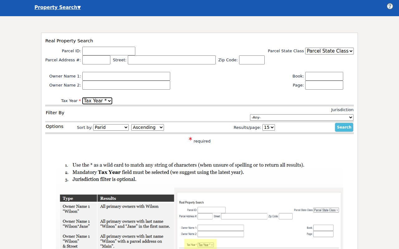
Its address and ZIP fields make the portal useful for a South Charleston ZIP code directory, while its parcel result still describes assessed property rather than every resident.
South Charleston ZIP Search Fields
IAS exposes a useful group of address inputs. Search with the least amount of reliable text first. A street spelling may differ across tax, postal, and older directory records, while a parcel ID can remain stable. Maintenance and refresh timing can vary in the statewide system, so save the date of each result.
| IAS Field or Mode | Input | Purpose | Limit |
|---|---|---|---|
| Parcel Address # | Street number | Narrows a property address | Not a person search |
| Street | Street name | Groups addresses on one road | Spelling and suffix can differ |
| Zip Code | Five-digit ZIP | Narrows assessment matches | Postal area may cross city line |
| Parcel ID | County, district, map, parcel, suffix | Identifies land record | Format must be correct |
| Parcel State Class | Property class | Further filters results | Does not identify occupants |
The Kanawha assessor's separate portal does not show a captured ZIP filter. It accepts owner, address, account, district, map and parcel, property type, legal description, and deed book or page. The Property Viewer searches E-911 address, owner, parcel, geometry, and coordinates, but no explicit ZIP field was captured. Those systems confirm the parcel after IAS or USPS narrows the postal clue.
The 25303 South Charleston Change
A USPS Postal Bulletin records a useful break in local address history. Effective October 4, 2014, the preferred last line for ZIP code 25303 changed from Charleston, West Virginia, to South Charleston, West Virginia. The physical property did not need to move for its preferred postal city name to change. A search limited to the modern wording can therefore miss older directories, notices, and family papers.
When tracing a 25303 person or address across that date, test both city names. Keep the same street number and ZIP when the source provides them. Then compare a parcel ID, lot, block, subdivision, or deed book and page. The official 2014 Postal Bulletin also identifies the classified branch at 400 D Street, providing a dated federal source for the change.
Historical search tip. An older “Charleston WV 25303” entry may still concern a South Charleston place. Confirm it with the parcel or street record instead of rejecting it by city name alone.
ZIP Codes Meet the 1906 Grid
South Charleston's planned street pattern adds another local layer. e-WV reports that the Kanawha Land Company acquired about 1,800 acres in 1906 and engineers laid out an orderly grid. Modern parcel records may preserve land identity through subdivision, lot, and block terms even when a postal label changes. Jefferson Park examples in MapWV show why legal descriptions can solve a mismatch that plain street text cannot.
Search the modern address first, then test the legal description from the parcel detail. A description such as a lot and block in a named addition is a recorded land clue. It is not a postal route. Deeds and plats establish the legal identity, while USPS establishes delivery. The city Engineering Department at 238 4th Avenue can address permit, code, and zoning questions when an official street or site issue remains unclear.
Official sources disagree on the city's incorporation milestone, using 1917 on a city page and 1919 in the Blue Book and sanitary-board history. Keep those dates attributed rather than forcing them into one claim. The grid's 1906 planning date is the useful address-search fact.
South Charleston ZIP Post Offices
The two facilities provide direct ways to resolve mail questions that a resident directory cannot answer. The South Charleston Post Office listing confirms the 400 D Street facility and 25303 address. The Southridge Centre listing confirms 2470 Mountaineer Boulevard and 25309. Ask USPS about the deliverable address and preferred city line, not parcel ownership or incorporation.
South Charleston Post Office
400 D Street
South Charleston, WV 25303-9998
304-744-7357
Southridge Centre
2470 Mountaineer Boulevard
South Charleston, WV 25309-9997
304-746-0124
The USPS lookup screenshot shows the federal source used to test an address or ZIP.
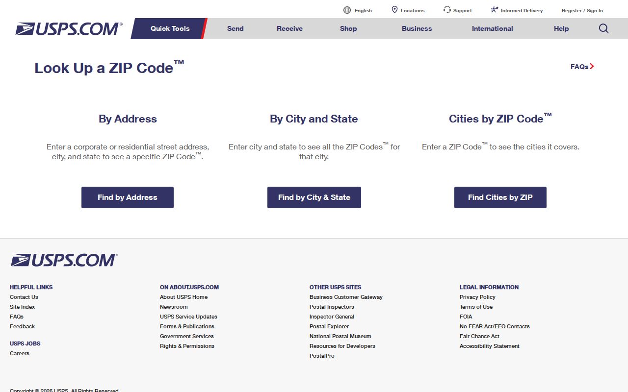
Use its answer as postal evidence. A second check in GIS is still needed for city-limit or parcel questions.
Resident Rolls Without ZIP Browsing
Not every people-bearing record can be opened by postal code. The Kanawha assessor accepts address and parcel fields but has no captured ZIP input. MapWV can locate an E-911 or property address and draw geometry, yet its result limit is 1,000 and ZIP is not a dedicated filter. The public voter form requires one person's first name, last name, and date of birth. It cannot browse residents in 25303 or 25309.
A lawful voter-file request may expose selected fields under WV Code §3-2-30, but the process is not the public status form. The law excludes phone, email, Social Security number, driver-license number, and nonoperator-ID number. It restricts solicitation, advertising, resale, and reproduction for resale. Treat public voter fields as dated registration information, not proof that someone is physically present.
Municipal permit, zoning, and code files may accept an address request, but no city permit index was located. Court and vital records remain person-centered and subject to their own access limits. A ZIP code is therefore a narrowing device, not a key that unlocks every South Charleston record set.
South Charleston ZIP and City Limits
ZIP codes are delivery geographies. They are not municipal borders. A 25303 or 25309 last line does not prove that a parcel sits inside South Charleston. Check the address against the West Virginia Property Viewer, county parcel data, and the city's ward or zoning map. Preserve four different facts when a record supplies them: postal ZIP, parcel situs, tax mailing address, and legal description.
- ZIP versus ZIP+4
- A ZIP is the five-digit delivery area. ZIP+4 adds a four-digit segment that narrows delivery to a smaller route or group.
- PO-box ZIP
- A postal code assigned mainly or solely to post-office boxes rather than street delivery.
- Unique ZIP
- A code assigned to one large organization or site because of its mail volume.
- Carrier route
- The set of addresses served by one postal delivery route within a ZIP.
No verified source identified 25303 or 25309 as a PO-box-only or unique code, and no complete official mismatch list was located. Both local facilities do list around-the-clock box access. State the known service facts without turning them into unsupported boundary claims.
Keep the layers separate. USPS answers how mail is addressed. GIS shows mapped parcels. Deeds establish legal land identity, and city maps address municipal jurisdiction.